Embed Size (px)
Citation preview

Rev. IG, São Paulo, 12(1/2), 87-94, jan./dez./1991
THE COLÔNIA ASTROBLEME, BRASIL
Claudio RICCOMINI
Bruno TURCQLouis MAR TIN
Marcelo Z. MOREIRAMaria L. LORSCHEITTER
RESUMO
A estrutura de Colônia está localizada a cerca de 35km ao sul do centro da cidade de
São Paulo. Ela apresenta formato circular, com 3,64km de diâmetro, estando preenchida porpelo menos 263m de sedimentos, correspondendo a uma provável estrutura de impacto, ouastroblema.
Essa feição é delineada por um anel externo circular, de relevo colinoso, desniveladode até 125m em relação a uma planície aluvial interna pantanosa.
Este artigo apresenta um esboço da geologia regional da área e discute as diferentes hipóteses concernentes à origem da estrutura, bem como os parâmetros morfológicos pertinentesà compreensão desta feição extremamente particular.
São apresentados também os resultados preliminares do estudo das amostras obtidas porvibrotestemunhador.
ABSTRACT
About 35km south of the city of São Paulo, near Colônia, within Precambrian crystalline basement rocks, there is a well-defined ring feature, with 3.64km in diameter and filledby at least 263m of sediments, which corresponds to a probable astrobleme.
It is defined by a hilly circular outer rim up to 125m higher than an inner alluvial plainpresently occupied by a large swamp.
This paper explains the regional geology of the area and discusses the different hypothesis as to the origin of the structure as well as the morphological parameters pertinent to anunderstanding of this feature.
Preliminary vibrocore data are also presented.
1 INTRODUCTION
Fewer than 150 impact structures of celestial orinterplanetary bodies at the Earth's surface, the so-calIed astroblemes, are recognizedover our planet (GRIEVE & ROBERTSON,1979, 1987). The study of astroblemes has recently increased because impact cratering wasa fundamental process in the evolution of alI theterrestrial planets (SHOEMAKER, 1977), henceits importance in comparative planetology.
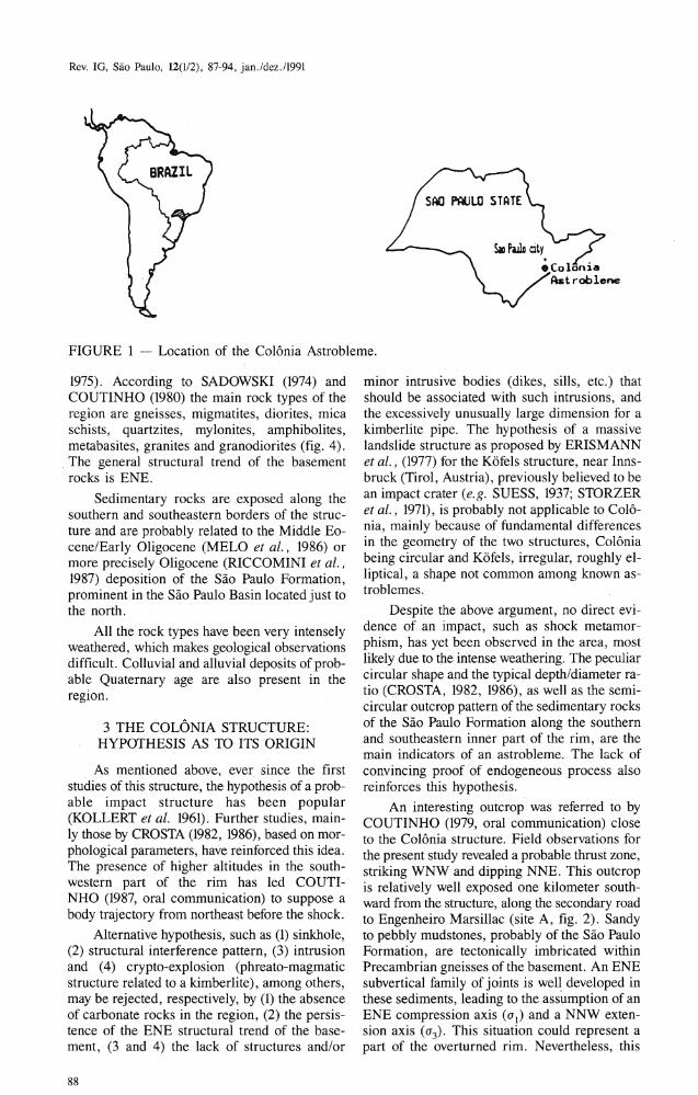
About 35km from São Paulo, near Colônia(fig.l), there is a conspicuous ring feature, 3.64km in diameter, centered at 23 052' S,46°42'20"W, within Precambrian crystalIinebasement rocks, and defined by a hilIy circularouter rim up to 125 m (figs. 2 and 3) higher thanan inner alIuvial plain presently occupied by alarge swamp, where the present-day water leveImay be, in part, controlIed by the Billings reservoir just to the east.
The structure is locatedin the border of the
Serra do Mar, a coastal mountain chain originalIycovered by the "Mata Atlântica" tropical rainforest with localized occurrences of Araucaria
angustifolia (Bertol). Kuntze.
The hypothesis that this feature is a probable impact structure has long been postulated,ever since the first studies carried out in the area
(KOLLERT et ai., 1961).
In this paper the regional geology is brieflyexplained, different hypothesis as to the originof the structure are discussed, and morphological parameters pertinent to an understandingof this feature are given. Preliminary vibrocoredata are also presented.
2 REGIONAL GEOLOGICAL SETTING
The Colônia structure is located within the
domain of the Ribeira Fold Belt (HASUI et ai. ,
87
Rev. IG, São Paulo, U(I/2), 87-94, jan./dez./199l
FIGURE 1 - Location of the Colônia Astrobleme.
1975). According to SADOWSKI (1974) andCOUTINHO (1980) the main rock types of theregion are gneisses, migmatites, diorites, micaschists, quartzites, mylonites, amphibolites,metabasites, granites and granodiorites (fig. 4).
. The general structural trend of the basementrocks is ENE.
Sedimentary rocks are exposed along thesouthern and southeastern borders of the structure and are probably related to the Middle Eocene/Early Oligocene (MELO et ai., 1986) armore precisely Oligocene (RICCOMINI et ai. ,1987) deposition of the São Paulo Formation,prominent in the São Paulo Basin located just tothe north.
All the rock types have been very intenselyweathered, which makes geological observationsdifficult. Colluvial and alluvial deposits of probable Quaternary age are also present in thereglOn.
3 THE COLÔNIA STRUCTURE:HYPOTHESIS AS TO ITS ORIGIN
. As mentioned above, ever since the firststudies of this structure, the hypothesis of a probable impact structure has been popular(KOLLERT et ai. 1961). Further studies, mainly those by CROSTA (1982, 1986), based on morphological parameters, have reinforced this idea.The presence of higher altitudes in the southwestern part of the rim has led COUTINHO (1987, oral communication) to suppose abody trajectory from northeast before the shock.
Alternative hypothesis, such as (1) sinkhole,(2) structural interference pattern, (:3) intrusionand (4) crypto-explosion (phreato-magmaticstructure related to a kimberlite), among others,may be rejected, respectively, by (1) the absenceof carbonate rocks in the region, (2) the persistence of the ENE structural trend of the basement, (3 and 4) lhe lackof structures and/or
88
minor intrusive bodies (dikes, sills, etc.) thatshould be associated with such intrusions, andthe excessively unusually large dimension for akimberlite pipe. The hypothesis of a massivelandslide structure as proposed by ERISMANNet ai., (1977) for the Kõfels structure, near Innsbruck (Tirol, Austria), previously believed to bean impact crater (e.g. SUESS, 1937; STORZERet ai., 1971), is probably not applicable to Colônia, mainly because of fundamental differencesin the geometry of the two structures, Colôniabeing circular and Kõfels, irregular, roughly elliptical, a shape not common among known astroblemes.
Despite the above argument, no direct evidence of an impact, such as shock metamorphism, has yet been observed in the area, mostlikely due to the intense weathering. The peculiarcircular shape and the typical depth/diameter ratio (CROSTA, 1982, 1986), as well as the semicircular outcrop pattern of the sedimentary rocksof the São Paulo Formation along the southernand southeastern inner part of the rim, are themain indicators of an astrobleme. The lack of
convincing proof of endogeneous process alsoreinforces this hypothesis.
An interesting outcrop was referred to byCOUTINHO (1979, oral communication) doseto the Colônia structure. Field observations forthe present study revealed a probable thrust zone,striking WNW and dipping NNE. This outcropis relativelywell exposed one kilometer southward from the structure, along the secondary roadto Engenheiro Marsillac (site A, figo 2). Sandyto pebbly mudstones, probably of the São PauloFormation, are tectonically imbricated withinPrecambrian gneisses of the basement. An ENEsubverti cal family of joints is well developed inthese sediments, leading to the assumption of anENE compression axis (0"1) and a NNW extension axis (0"3)' This situation could represent apart of the overturned rim. Nevertheless, this

Rev. 10, São Paulo, U(1I2) , 87-94, jan./dez./1991
FIGURE 2 - Topographic map of the Colônia Astrobleme (57 to 61 X 24 to 29) with locations(A-G) of sites mentioned in the texto Contour interval20m. Source: Instituto Geográfico e Geológico de São Paulo, 1971.
89

Rev. IG, São Paulo, 12(1/2), 87-94, jan.ldez.l1991
FIGURE 3 - Stereo-pair of the Colônia Astrobleme. Original scale of the photos 1:35,000.Source TERRAFOTO/EMPLASA, 1980-1981.
90

Rev. IG, São Paulo, 12(1/2), 87-94, jan./dez./1991
4 ANALYSIS OF THE MORPHOLOGICALPARAMETERS OF THE STRUCTURE
deformation pattern is not completely incongruous with the traaspressional event of postOligocene to Pleistocene age observed in theregion (RICCOMINI et aI., 1989).
Ali of the above considerations concerningthe pattern of Tertiary sedimentation point to anOligocene or younger geologic age for the impact event.
world, have verified a 600 Ma recognizable lifefor craters less than 20 km in diameter, according to DENCE's seven-stage scale. TheColônia structure lies between preservationaldegrees 3 and 4, i .e., a structure with ejecta removed, rim partly preserved, although deeplyeroded, and crater-fill products preserved.GRIEVE & ROBERTSON (1979) have established an empirical relationship between diameter, age and preservational degree of impactstructures, in order to estimate the maximum ageof structures with a given dimension. The observed preservation degree is plotted against apreservation index defined by the ratio betweenthe diameter in kilometers and the age in Ma.Given the 3.64 km diameter and the preservationai degree between 3 and 4 of the Colônia Astrobleme, the maximum impact age would rangebetween 36.4 Ma (Eocene-Oligocene boundary)and 5.2 Ma (Miocene-Pliocene boundary), dateswell in agreement with the maximum age ofOligocene postulated on other grounds.
Also according to GRIEVE & ROBERTSON (1979) the depth-diameter relationships forsimple craters with diameters less than 3.8 kmin crystalline targets are described by thefunctions:
Pt = 0.326 D0786 ,
Pa = 0.159 DO.829 ,
where Pt and Pa are, respectively, the true andapparent depths in kilometers and D is the rimdiameter also in kilometers. The true depth corresponds to the altitude difference between thetop of the rim and the base of the crater-fill,whereas the apparent depth is the difference between the top ofthe rim and the top ofthe craterfil!. Using these relationships, the Pt and Pa
parameters for the Colônia structure are respectively 900 and 464 meters. Theoretically, therefore, the crater-fill should be 436 meters thick.
The present vertical distance from the topof the rim to the top of the crater-fill is around125m. The difference with respect to the calculated Pa may be explained by the action of intense weathering and erosion.
There is no available data on the maximum
crater-fill thickness. Geophysical (gravimetry andresistivity) surveys indicated 300-400 m for thedepth to the crystalline substratum within thecrater. A water-well, originally 190 m in depth(site B, figo 2) was drilled in the southern partof the structure, about 650 m from its center, anddoes not reach the basement (CEPAS, 1989).Later this well was continued down to 263 m
depth, where it was reported that the drilling hadreached the basement. It is possible, however, that
3kmI
2!
oI
1\ :.: :':..:234
FIGURE 4 - Geology of the Colônia area, after COUTINHO (1980), simplified. Precambrian: 1 - mica schists, quartzites, 10callymylonites; 2 - gneisses, migmatites, also locally mylonites; 3 - diorites and quartz diorites.Tertiary: 4 - São Paulo Formation. Quaternary:5 - alluvial deposits. Structures: 6 - crater rim;7 - structural trend of the Precambrianbasement.
DENCE (1972) has classified terrestrial impact craters in seven different levels or degreesof preservation: I: ejecta largely preserved; 2:ejecta partly preserved; 3. ejecta removed and rimpartly preserved; 4: rim largely eroded andcrater-fill products preserved; 5: crater-fillproducts partly preserved; 6: only remnants ofcrater-fill products preserved, with crater floorexposed; 7: crater floor removed, substrateexposed.
GRIEVE & ROBERTSON (1979), studyingthe morphology of the 140, proven, probable andpossible, impact structures known throughout the
91

Rev. IG, São Paulo, 12(1/2), 87-94, jan.ldez.l1991
..•. õ:!! •.!!
NN •••••
SSE
.~
E.;: 1250m
11 /''000:._I ''-,-
~ t + '
750
Lr '."- +
"- + ......., 500
250
o-I
o
5001000m
NNW
SSESPF
FIGURE 5 - Upper: idealized section across Colônia Astrobleme, showing available data (heavylines), and theoretical parameters after GRIEVE & ROBERTSON (1979, dashed line). Pa:apparent depth; Pt: true depth; D: diameter; C.F.: crater-fill thickness; G: depths accordingto geophysical data. Below: interpretation of sedimen1tary deposition.
100
o ' •.' i i iEm "
(}~
~.~I;-.(2B1BD .
+8&60/-36002BOSD
+2430/-1870..._...•. ~, ..•.,
200
400
300
Greyish bl.,k (112) elay, locallyrich in fi". planto r•••• in.;tMt. •• an 36 and 40 c.. the 00 lou rbee •••••• bl.ekillh brawn (5YR2/1)
1mB;"·'.
Locally rich in fr •• h ~r't.z grainsLocally rich in fine ••ic-.;eota aend
Gr.yi.h black (112) elay, laca1lyrich in fine plant ,.._:1•.••
Gr.yi.h black cl.y ••ithhorizont.al 1l11'ltinllt.ions af fine
pl.nt ren.in., .0fIt. coa,.. •• ()lc•••)planto r.lIlI~ins
500
600
700 _Greyish black (112) clay ••ith
coarse (> 1 cn) pl~t. re" ••ins800
CIlI
~---.-----~~.. ,..~-
iI1
I I I I I-30 -28-25 -24 -22
r•I I I I I I ••0102030 405060
\\.\.J
'\'.
I I I I I I I20304050607080
FIGURE 6 - Core C05: description, Ó 13 C %0, C%, CIN.
92

Rev. IG, São Paulo, 12(1/2), 87-94, jan.ldez.ll991
this leveI, 263 m below the alluvial plain, couldmerely represent the top of the initial, coarse,crystalline fill eroded from the slopes of innerpart of the rim.
Drilling has revealed essentially organic-richclayey material. As shown in Fig. 5, however, the263 meters drilled depth and the 300-400 metersobtained by geophysical survey are in agreementwith the theoretical values for the thickness ofcrater-fill sediments based on the parameters PtPa (C.E).
5 LATE PLEISTOCENE SEDIMENTATION
The Colônia depression, as a small basinwith high sediment accumulation, is a good sitefor paleoclimatic studies. Such studies are beingsupported by the "Intertropical Paleoclimates"program of ORSTOM-CNPq accord and by theGEOCIT program of ORSTOM. In 1987 fieldwork resulted in the collection of 5 vibrocores
of 4.65, 7.52, 7.80, 5.60 and 8.78 m, respectivelycores COI-C05 (sites C-G, figo 2).
The vibrocorer is a conception of one of theauthors (L.M.). Vibrocores were taken in twodifferent zones of the depression, in accordancewith the possibilities of transportation. Only thepreliminary results of analises of core C05 arepresented here (fig. 6).
The sediments, along the 878 cm of coreC05, are organic rich, with a greyish-black (N2)to brownish-black (5YR 2/1) color (fig. 6). Theyare mainly made up of clays. Some fresh quartzgrains, with diameters of 1 to 3 mm, appears below 227 cm depth. Between 253 and 265 cm thefaCÍes is a greyish black micaceous fine sand.Beneath this limit the sediments continue c1ayeyand organic rich with an alternation of finelaminated plant fragments and larger plant remains (fig. 6). The quantity of large plant remains, including fruits and spines, increases inthe last two meters at the base of the core.
The 14C dates obtained in ORSTOM laboratories in Bondy (France) show that the sedimentsare Pleistocenic, almost ali the core being olderthan the latest glacial maximum: at 54-57 cmdepth the radiocarbon age-date is 18,180+/- 930years BP. The sedimentation rate between 54 and225 cm is about 0.02 cm/y.
The sandy sedimentation event is difficultto date precisely because of the broad marginof error for the obtained values: 28,180(+6660,-3600) years BP for the minimum age(222-225cm), and 28,050 (+2430,-1870) yearsBP for the maximum age (267-270cm).
Organic carbon fluctuates between 8 and35 % from the top of the core to the sandy layer,
where it attains 5.6 %. It increases abruptly below this levei with values between 44 and 56%(fig. 6).
The carbon to nitrogen ratio (C/N) is high,attaining a maximum of 74 immediately belowthe sandy facies. High C/N correspond to terrestrial (non-planktonic) vegetation. Further studiesof in situ vegetation are necessary for the interpretation of C/N variations.
Analysis of the stable isotopic carbon ratio(o 13C) were performed by CENA/USP, Piracicaba. The 013C also presents a drastic change inthe sandy bed (fig. 6). The values lie between-22.72 and -24.29 per mille in the upper part,and between -27.02 and -28.56 per mille in thesandy layer and below, these last values corresponding to a vegetation with C3 photosyntheticcycle. Higher o 13C values in the upper part ofthe core may be due to the introduction of plantswith C4 cycle, such as grasses, or plants with acrassulacean acid metabolism (CAM).
The available data show that at the site of the
C05 core the filling-up, of the depression nearly stopped after the glacial maximum of 18,000years B.P.
Preliminary pollen studies (LORSCHEITTER et aI., 1990) showed between 7.50 and 6mthe presence of forest vegetation, probably corresponding to a mild c1imate. There follows agradual forest decreasing and a field vegetationincreasing up to about 2.73m (28,050 B.P.), probably related to a cold c1imate of serni-aridity. From2.73m to the upper part of the C05 vibrocoringthere is a drastic reduction of forest elements,coinciding with a big increasing of field elements,indicating a dry paleoclimate until 18,180 B.P.
6 FINAL CONSIDERATIONS
In spite of the lack of direct evidence, theColônia structure is probably an astrobleme.Preliminary studies of the Quaternary sedimentation are promising and further studies shouldbe undertaken, such as (1) study of presentsedimentary environrnents and the ecology of thisparticular swamp, (2) a second set of vibrocorings in order to sample the Holocene period, and,mainly, (3) the realization of a deep core throughthe complete crater-fill in order to obtain a continuous record of Quaternary and eventually earlier deposits.
7 AKNOWLEDGEMENTS
The authors thank Drs. Armando M. Coimbra, K. Suguio and l-Mo Flexor for their helpduring field work, and Dr. Thomas R. Fairchildfor correction and improvement of the Englishof the original version.
93

Rev. IG, São Paulo, U(1/2), 87-94, jan./dez.l1991
8 REFERENCES
CENTRO DE PESQUISAS DE ÁGUAS SUBTERRÂNEAS (CEPAS), 1989. Atiyidades1984-1988. Instituto de Geociências, Universidade de São Paulo, 433p.
COUTINHO, 1.M.Y., 1980. Mapa geológico daGrande São Paulo, 1:100.000.São Paulo EMPLASA, 2 sheets.
CROSTA, A.P., 1982. Estruturas de impacto noBrasil: uma síntese do conhecimento atual,32':' Congresso Brasileiro de Geologia, SBG,v. 4, p. 1372-1377.
CROSTA, A.P., 1987. Impact structures inBrazil. In: POHL, 1., ed., Research in terrestrial impact structures. Friedr. Vieweg &Son, Braunschweig/Wiesbaden, p. 30-38.
DENCE, M.R., 1972. The nature and significance of terrestrial impact structures.24th International Geological Congress, Section 15, p. 77-89.
ERISMAN, Th., HEUBERGER, H. &PREUSS, E., 1977. Der Bimsstein vonKõfels (Tirol), ein Bergsturz-"Friktiomit".TMPM, 24, p. 67-119.
GRIEVE, R.A.F. & ROBERTSON, P.B., 1979.The terrestrial cratering record, I. currentstatus of observations. Icarus, 38, p. 212-219.
GRIEVE, R.A.F. & ROBERTSON, P.B., 1987.Terrestrial impact structures. Geol. Soe.Canada, map 1658 A, scale 1:63.000,000.
HASUI, Y., CARNEIRO, C.o.R. & COIMBRA,A.M., 1975. The Ribeira Folded Belt. Rev.Bras. Geoc., 5, p. 257-266.
KOLLERT, R., BJÓRNBERG, A. & DAVINO,A., 1961. Estudos preliminares de umadepressão circular na região de Colônia: StoAmaro, São Paulo. BoI. Soc. Bras. Geo1.,10, 57-77.
LORSCHEITTER, M.L.; TURCQ, B.; RICCOMINI, C. 1990 Palinologia de sedimentos paludosos de Colônia, São Paulo, Brasil.Paleobotânica Latinoamericana, 9, p. 27.
MELO, M.S., CAETANO, S.L.Y. & COIMBRA, A.M., 1986. Tectônica e sedimentação na área das bacias de São Paulo eTaubaté. 34':' Congresso Brasileiro de Geologia, SBG, v. 1, p. 321-336.
RICCOMINI, c., APPI, c.1., FREITAS, E.L.& ARAI, M., 1987. Tectônica e sedimenta-
. ção no Sistema de Rifts Continentais da Serra do Mar (bacias de Volta Redonda,Resende, Taubaté e São Paulo). I'? Simpósio de Geologia Rio de Janeiro - EspíritoSanto, SBG, p. 252-298.
RICCOMINI, C., PELOGGIA, A.Y.G., SALONI, 1.c.L. KOHNKE, M.w. & FIGUEIRA,R.M., 1989.Neotectonic activity in the Serrado Mar Rift System. 1. South Am. EarthSciences, 2, p. 191-197.
SADOWSKI, G.R., 1974. Tectônica da Serra deCubatão, SP. Dr. Sci. Thesis, Instituto deGeociências, Universidade de São Paulo,159p.
SHOEMAKER, E.M., 1977. Why study impactcraters? In: RODDY, 0.1., PEPIN, R.O. &MERRIL, R.B., eds., Impact and implosioncratering. Pergamon, Elmsford, NY, p. 1-10.
STORZER, D., HORN, P. & KLEINMANN,B., 1971.The age and origin of Kõfels structure, Austria. Earth Planet. Sci. Lett., 12,p. 238-244.
SUESS, F.E., 1937. Der Meteor-Krater vonKõfels bei Umhausen im Otzale. Tirol. N.Jb. Min., Geo1. und Palãont., Abh. 72,Beilage-Bd. Abt. A, p. 98-155.
Trabalho apresentado como guia de excursão no Illternational Symposium on Global Changes in South America Duringthe Quaternwy, Past-Present-Future, patrocinado pela Associação Brasileira de Estudos do Quaternário (ABEQUA) e International Unionfor Quaternary Research (INQUA), São Paulo, Brasil, de 8 a 12 de maio de 1989, com pequenas modificações.
Endereço dos autores:- Claudio Riccomini - Instituto de Geociências, Universidade de São Paulo - Caixa Postal 20.899 - 01498 - São Paulo,
SP - Brasil.
- Bruno Turcq e Louis Martin - Institut Français de Recherche Scientifique pour le Développement en Coopé. ration (ORSTOM), Centre ORSTOM de Bondy, Laboratoire des Formations Superficielles, 70-74 Route d'Aulnay, 93140
Bondy (France).- Marcelo Z. Moreira - Centro de Energia Nuclear na Agricultura - Caixa Postal 96 - 13400 - Piracicaba, SP - Brasil.- Maria L. Lorscheitter - Universidade Federal do Rio Grande do Sul - Departamento de Botânica - Rua Sarmento
Leite s/n - 90000 - Porto Alegre, RS - Brasil.
94