Embed Size (px)
Citation preview
Centro de Referência em Nomes Geográficos - IBGE
Description of the Fieldwork Area
The UNGEGN & IBGE Toponymy Course
Rio de Janeiro, May, 2017
REFERÊNCIA E IDENTIDADE
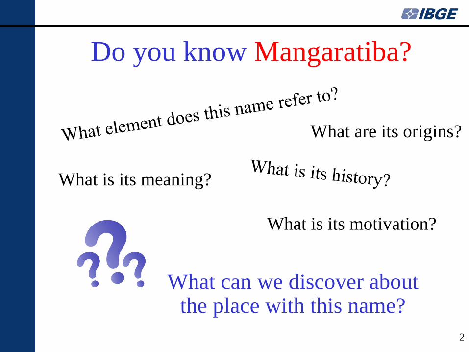
Do you know Mangaratiba?
What are its origins?
What is its meaning?
What can we discover about the place with this name?
What is its motivation?
2
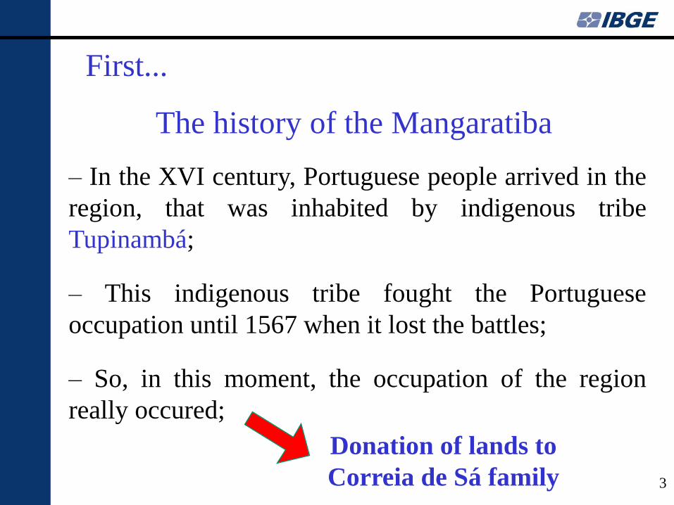
– In the XVI century, Portuguese people arrived in the
region, that was inhabited by indigenous tribe
Tupinambá;
– This indigenous tribe fought the Portuguese
occupation until 1567 when it lost the battles;
– So, in this moment, the occupation of the region
really occured;
First...
The history of the Mangaratiba
3
Donation of lands to
Correia de Sá family
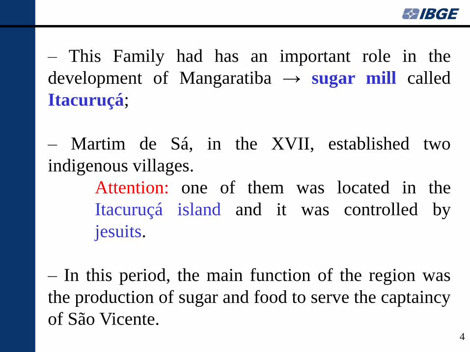
– This Family had has an important role in the
development of Mangaratiba → sugar mill called
Itacuruçá;
– Martim de Sá, in the XVII, established two
indigenous villages.
Attention: one of them was located in the
Itacuruçá island and it was controlled by
jesuits.
– In this period, the main function of the region was
the production of sugar and food to serve the captaincy
of São Vicente.
4
5
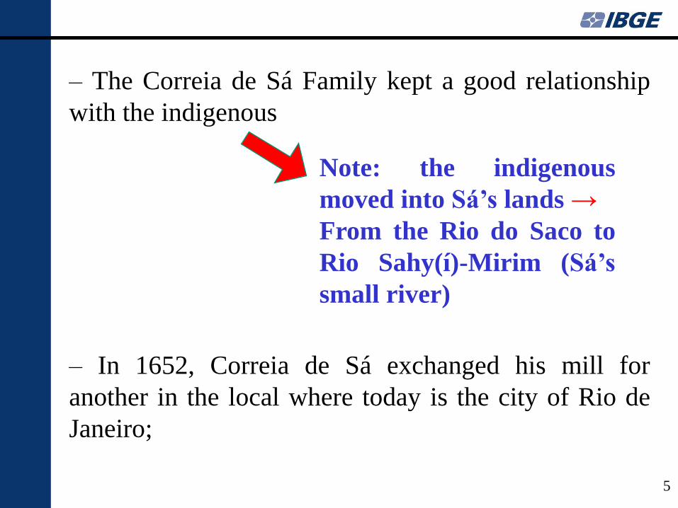
– The Correia de Sá Family kept a good relationship
with the indigenous
– In 1652, Correia de Sá exchanged his mill for
another in the local where today is the city of Rio de
Janeiro;
Note: the indigenous
moved into Sá’s lands →
From the Rio do Saco to
Rio Sahy(í)-Mirim (Sá’s
small river)
6
– After the sugar cane economic cicle in Brazil, gold
became the main product of Brazil’s economy;
– In this sense, the focus of the governamental
authorities was to protect this product until its departure
to the metropolis → new road to connect Rio de Janeiro
to São Paulo to avoid the risk of transporting gold in the
sea → “Estrada Real” → Development of a region in
Mangaratiba’s mountains → “São João Marcos”
– The government promoted the occupation of the area
through the donation of lands;
Note: one person had an important role in this
moment → the “pilot of ropes” (Piloto de
Cordas) João Cardoso de Mendonça Lemos
7
– At the same time, the production of “cachaça”
increased in Mangaratiba so as to be used to pay for
slaves in the slave trade;
– During the XVIII century, Mangaratiba had an
extensive influence in the dynamics of the slave trade;
– Already in the XIX century, other product emerged
in the economical scenario: COFFEE;
– The plantations of coffee were being expanded to all
the mountain region → Piraí, Barra Mansa, São João
Marcos, among others…
8
– So, two main activites co-existed in this period: the
exportation of coffee and the slave trade →
Mangaratiba became an important trading post,
especially with the presence of the port;
– Important person in this context: Joaquim José de
Souza Breves, “the king of coffee”, the major slave
dealer of the country. He settled in Mangaratiba and
promoted the increase of the port’s activities;
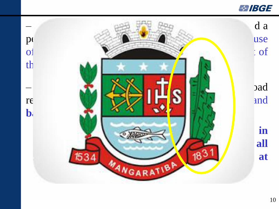
– Mangaratiba, with this development, became a “vila”
in 1831, called Nossa Senhora da Guia de Mangaratiba;
Note: In the middle of the XIX century,
this port was the main port of Brazil;
9
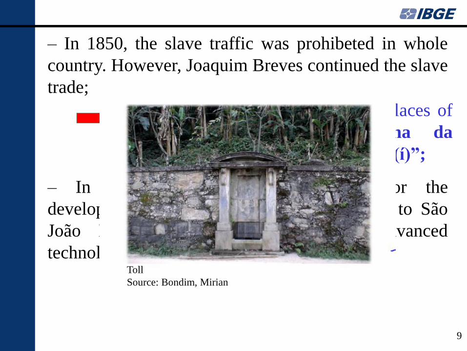
– In 1850, the slave traffic was prohibeted in whole
country. However, Joaquim Breves continued the slave
trade;
– In 1857, another important fator for the
development, a road to connect Mangaratiba to São
João Marcos was constructed, using advanced
technology, the “Imperial Road” (RJ-149);
Note: two areas were important places of
disembarking of slaves: “Ilha da
Marambaia” and “Praia do Sahy(í)”;
Toll
Source: Bondim, Mirian
10
– In the end of the XIX century, Mangaratiba entered a
period of decline → the end of the slave trade, the use
of the railroad to distribute coffee and the high cost of
the toll to use the Imperial road;
– The context only changed in 1914 when the railroad
reached Mangaratiba → transport wood, coal, fish and
bananas;
Note: The plantations of bananas in
the region was important during all
its history (since the XVI century, at
least);
11
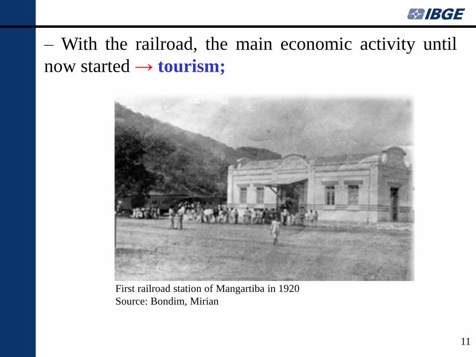
– With the railroad, the main economic activity until
now started → tourism;
First railroad station of Mangartiba in 1920
Source: Bondim, Mirian
– Mangaratiba is a municipality of Rio de Janeiro
State;
– The city is located in the south coast, in a region
called “Costa Verde”;
– The area has an interesting particularity: sea and
mountain are very close;
And nowadays?
A little about the enviromental and social
context of the area
12
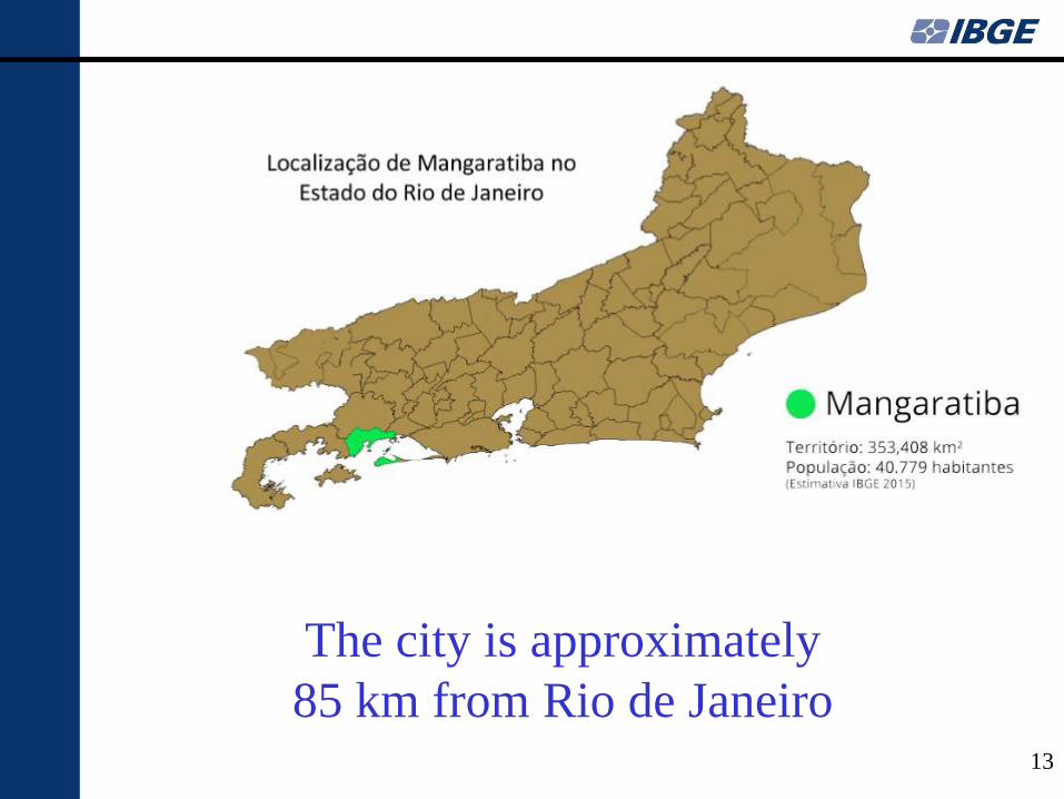
The city is approximately
85 km from Rio de Janeiro 13
14
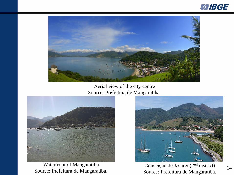
Aerial view of the city centre
Source: Prefeitura de Mangaratiba.
Waterfront of Mangaratiba
Source: Prefeitura de Mangaratiba. Conceição de Jacareí (2nd district)
Source: Prefeitura de Mangaratiba.
15
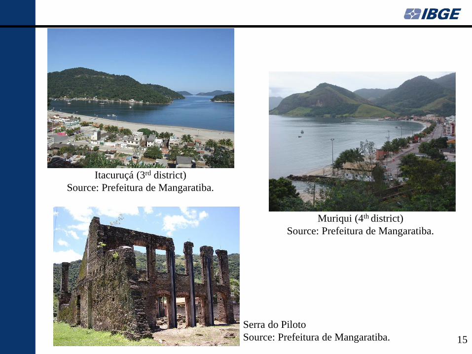
Serra do Piloto
Source: Prefeitura de Mangaratiba.
Itacuruçá (3rd district)
Source: Prefeitura de Mangaratiba.
Muriqui (4th district)
Source: Prefeitura de Mangaratiba.
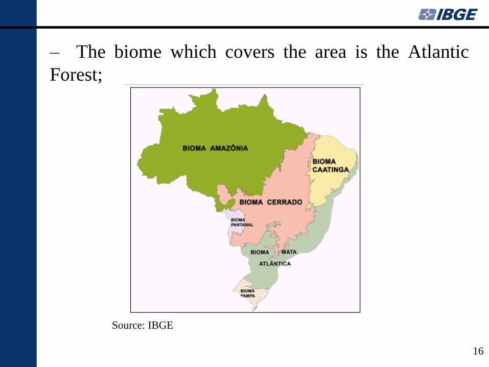
– The biome which covers the area is the Atlantic
Forest;
16
Source: IBGE
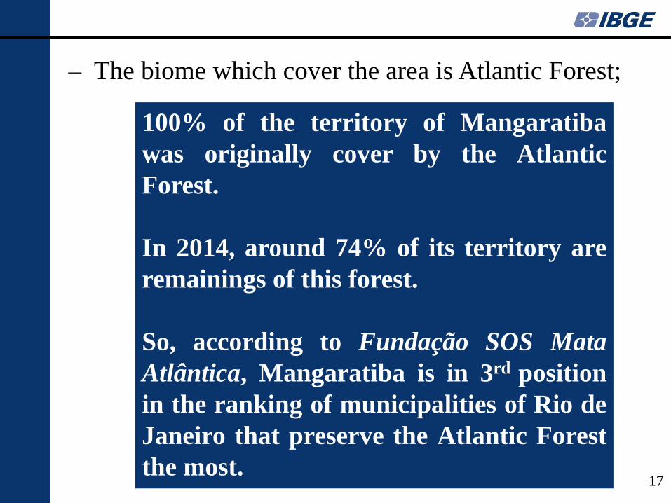
– The biome which cover the area is Atlantic Forest;
17
Source: Fundação SOS Mata Altlântica, 2014;
100% of the territory of Mangaratiba
was originally cover by the Atlantic
Forest.
In 2014, around 74% of its territory are
remainings of this forest.
So, according to Fundação SOS Mata
Atlântica, Mangaratiba is in 3rd position
in the ranking of municipalities of Rio de
Janeiro that preserve the Atlantic Forest
the most.
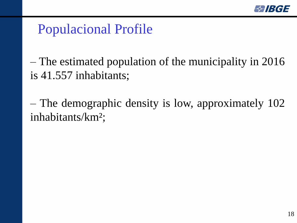
– The estimated population of the municipality in 2016
is 41.557 inhabitants;
– The demographic density is low, approximately 102
inhabitants/km²;
Populacional Profile
18
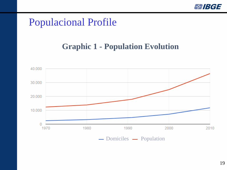
Graphic 1 - Population Evolution
Populacional Profile
19
Domiciles Population
Populacional Profile
20
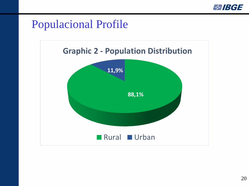
Populacional Profile
21
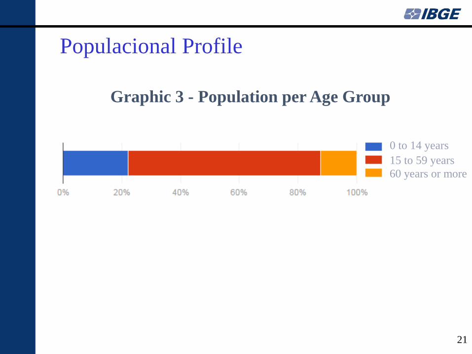
Graphic 3 - Population per Age Group
60 years or more
15 to 59 years
0 to 14 years
Populacional Profile
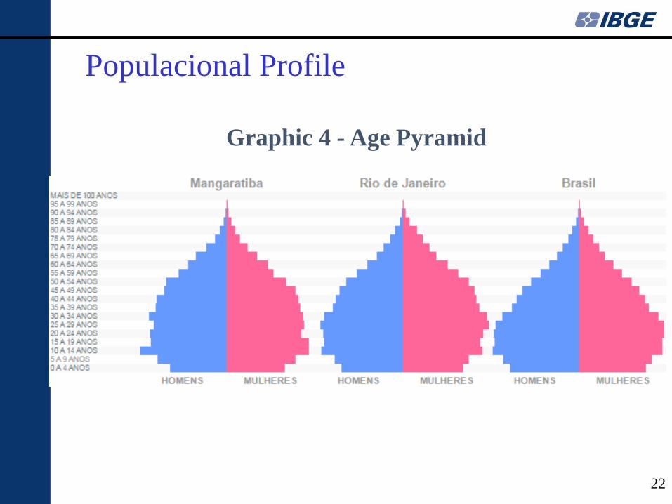
22
Graphic 4 - Age Pyramid
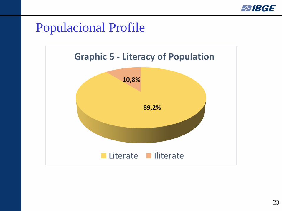
Populacional Profile
23
Populacional Profile
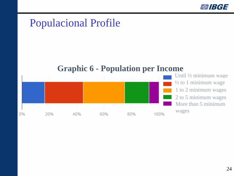
24
Until ½ minimum wage
1 to 2 minimum wages
More than 5 minimum
wages
2 to 5 minimum wages
½ to 1 minimum wage
Graphic 6 - Population per Income
– Tourism is the main economical activity in
Mangaratiba;
– The municipality has around 30 beaches in a 50 km
line of coast and also many islands;
– Besides the beaches, the city presents an expressive
cultural heritage related to its prosperous history,
specially, in the XIX century;
– So the tourism is diversified: historical, nautical and
summer vacation;
Touristic vocation
25
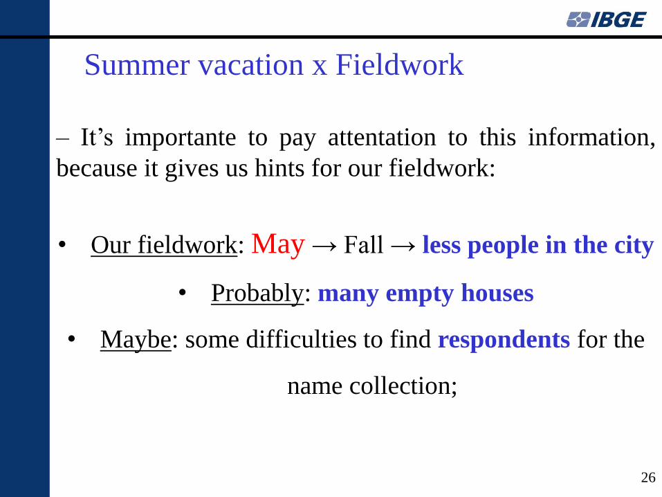
– It’s importante to pay attentation to this information,
because it gives us hints for our fieldwork:
• Our fieldwork: May → Fall → less people in the city
• Probably: many empty houses
• Maybe: some difficulties to find respondents for the
name collection;
Summer vacation x Fieldwork
26
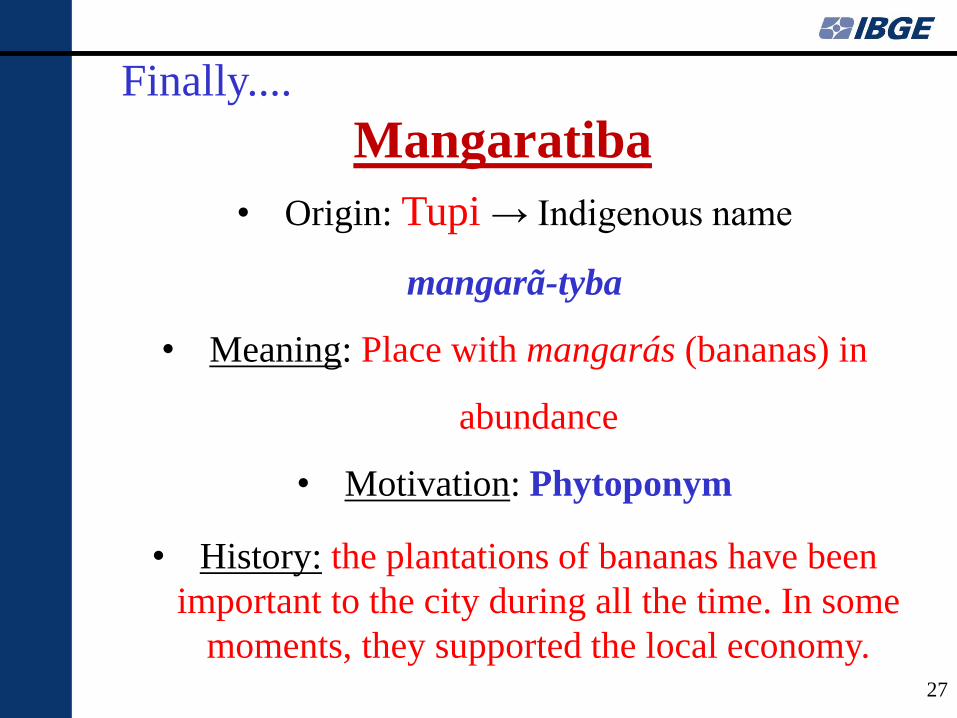
• Origin: Tupi → Indigenous name
mangarã-tyba
• Meaning: Place with mangarás (bananas) in
abundance
• Motivation: Phytoponym
• History: the plantations of bananas have been
important to the city during all the time. In some
moments, they supported the local economy.
Finally....
Mangaratiba
27
http://www.ibge.gov.br/home/presidencia/noticias/21052004biomashtml.shtm
https://www.sosma.org.br/102355/levantamento-inedito-mata-atlantica-rio/
http://www.mangaratiba.rj.gov.br/novoportal/pagina/dados-do-municipio.html
https://www.sosma.org.br/wp-content/uploads/2016/12/Atlas-municipios-SOS-Rio-de-Janeiro.pdf
BONDIM, Mirian. Resumo da História Econômica e Social de Mangaratiba. Disponível em:
http://concursos.biorio.org.br/Mangaratiba2015-SAG/legislacao/Resumo-Econ%C3%B4mico-e-
Social-da-Hist%C3%B3ria-de-Mangaratiba.pdf
SANTOS, Cláudio João Barreto dos. Geonímia do Brasil: A Padronização dos Nomes
Geográficos num Estudo de Caso dos Municípios Fluminenses. Tese (Doutorado em Geografia)
– Programa de Pós-Graduação em Geografia, Universidade Federal do Rio de Janeiro, Rio de
Janeiro. 2008.
References
28